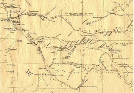
The Pecos River enters Texas just east of the 104th meridian. In Texas the river flows southeast, forming the boundary between Loving and Reeves, Reeves and Ward, Ward and Pecos, Pecos
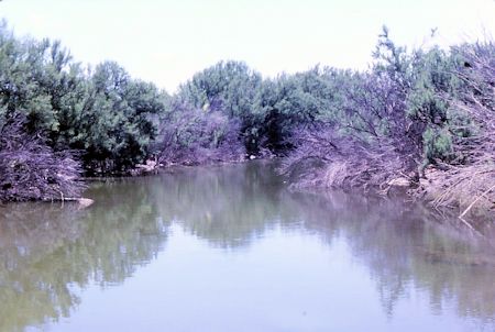
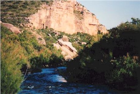
In addition to being a county boundary stream, the Pecos serves as the eastern boundary of the most mountainous and arid region of Texas, generally known as the Trans-Pecos. From below Sheffield in eastern Pecos County to the river's confluence with the Rio Grande, it passes through a deep gorge, which has long constituted a barrier to transportation and which has prevented irrigation from this part of the lower Pecos. Elsewhere along the course of the river, however, the diversion and impoundment of its water has radically altered its appearance in Texas. Early-day travelers described the river as generally sixty-five to a hundred feet wide and seven to ten feet deep, with a fast current. It was fordable at only a few places, the most famous of which was the Horsehead Crossing.
The earliest-known settlers along the river were the Pecos Pueblo Indians, who arrived about A.D. 800. Supposedly the first European to cross the river was Francisco Vázquez de Coronado, who reached the area in 1541. In 1583 Antonio de Espejo called the river the Río de las Vacas ("river of the cows") because of the number of buffalo in the vicinity. Gaspar Castaño de Sosa, who followed the Pecos northward, called it the Río Salado because of its salty taste, which caused it to be shunned by men and animals alike. According to Adolph F. Bandelier, the name Pecos first appears in Juan de Oñate's reports concerning the Indian pueblo of Cicuye, now known as the Pecos Pueblo, and is of unknown origin.
To Mexicans the river was long known as the Río Puerco ("dirty river"). The earliest European settlement was founded about 1636 at San Miguel del Bado in the upper valley of the Pecos. With the Anglo-American occupation of Texas, the middle and upper Pecos valley became the chief western cattle trail to the north, as well as the site of several famous cattle ranches. A small church group settled at St. Gall, Texas, in 1845, and Fort Lancaster was built near the river in 1855. Except for settlement around the fort, the earliest Anglo settlement in Texas on the river was Pecos, founded in 1881 when the Texas and Pacific Railway crossed West Texas.
Castle Gap and the Pecos River Frontier - Patrick Dearen
Advertisement
Update: 10 April 2020