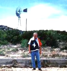
You won't find Howard's Spring in any travel brochure. I had always heard about Howard's Spring and had read the historical maker which is located over 25 miles from the spring. My mission was to find it. With the help of a GPS (Global Positioning Satellite) receiver, we found it. (30°28' N, 101°28' W)
First known to civilized men in the 18th century, when, according
to legend. Franciscan Padre Alvarez prayed for water to ease his
thirst, put down his staff, and saw a spring gush forth from the
ground, this landmark of western travel was named for its
re-discoverer, Richard A. Howard of San Antonio, an ex-Texas Ranger.
Howard and other men, along with 15 Delaware Indian guides, made up
an expedition sent out in 1848 under Col. John Coffee Hays to map a
wagon road from San Antonio to El Paso. Although aided by the
discovery of the well, the expedition failed, turning back in a
state of near-starvation. In 1849 the U.S. Army made its maps of the
route, with Howard along as a guide. Many forty-niners went this way
to the California gold rush. In 1853 the first regular San
Antonio-to-El Paso mail line was routed by way of the well. So were
many later ventures. Although white travelers seldom caught sight of
them, Indians frequented the well. There, on April 20, 1872,
Comanche and Kiowa surprised a large wagon train led by a man named
Gonzales, and killed 16 persons. This was one of the events that led
to the U.S. Government's cancellation of hunting permits for
reservation Indians.
(Historical Marker)
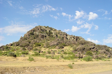
Howard Springs are a group of historical springs twenty-five miles southwest of Ozona in southwestern Crockett County (at 30°28' N, 101°28' W). They were important to early settlers traveling westward, as there was no other reliable water supply in the area. Native peoples occupied the spot for thousands of years, and in historical times it was a favorite living site of the Kiowa, who fiercely resisted being evicted from it. In 1872 they destroyed a wagon train here, killing eighteen travelers. The springs lie in the channel of Howard Draw. European-American ranchers have long overgrazed in the region, killing off the once abundant ground cover. This in turn increased the force of runoff, which washed gravel into the springs and filled them up. Seeps still emerge beneath the surface of a 200-meter-long pond in Howard Draw, but oilfield activities in recent years have contaminated the slightly saline water, which has been used in drilling.
Gunnar Brune, "HOWARD SPRINGS," Handbook of Texas Online (Link), accessed October 14, 2015. Uploaded on June 15, 2010. Published by the Texas State Historical Association.
Update: 10 April 2020